
Snow Day Predictor gives you a 7-day rolling snow day probability forecast for any city or ZIP code in the United States and Canada, completely free. But not all checks are equally accurate. The time you check Snow Day Predictor has a direct and significant impact on how reliable your forecast is, because weather model data improves dramatically over the 12 to 24 hours before a storm arrives.
This guide tells you exactly when to check, why those specific times matter, and how to build a two-check routine that gives you the most useful and accurate information during winter storm season.
Why Forecast Accuracy Changes Over Time
Before explaining the best check times, it helps to understand why timing matters so much for forecast accuracy in the first place.
Modern weather forecasting relies on numerical weather prediction models: mathematical simulations of the atmosphere that ingest billions of data points from satellites, weather balloons, ocean buoys, surface stations, and aircraft, then calculate how atmospheric conditions will evolve over time. The most widely used models include the Global Forecast System operated by NOAA, the European Centre for Medium-Range Weather Forecasts model known as the ECMWF, and the High-Resolution Rapid Refresh model known as HRRR.
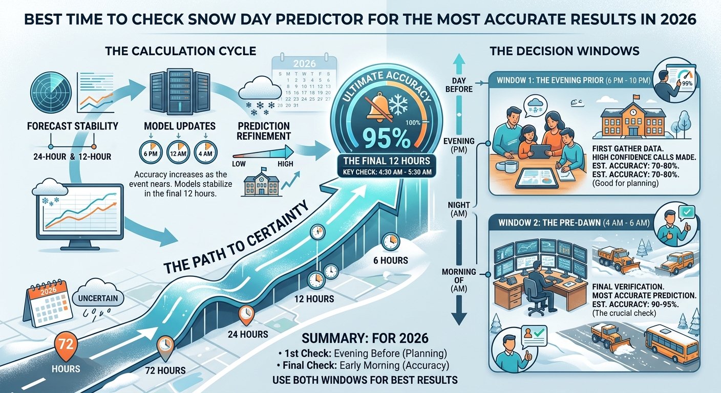
These models are updated on fixed schedules: the GFS runs four times daily at 0Z, 6Z, 12Z, and 18Z Greenwich Mean Time. The HRRR, which specializes in high-resolution short-range forecasting, runs hourly. As each model run ingests more recent observations, it produces progressively more accurate forecasts for the near-term period.
This means that a forecast produced at 6 PM is meaningfully more accurate than one produced at 6 AM for the same overnight period, because it has incorporated 12 additional hours of observational data. A forecast produced at midnight is more accurate still. And the 6 AM model run, available by approximately 8 to 9 AM, represents the highest-resolution, most data-rich forecast for the current day.
Snow Day Predictor pulls the latest available forecast data each time you submit a search, meaning the accuracy of your result is directly tied to what model data was most recently available when you checked.
The Two Best Times to Check Snow Day Predictor
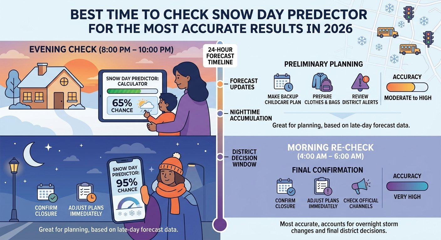
Check 1: The Evening Before, Between 6 PM and 10 PM
This is the primary planning check. By 6 PM, the 12Z model runs have been processed and the 18Z runs are becoming available, giving forecasters the best picture yet of what the overnight period holds.
By this point in a developing storm situation, the following questions have usually been answered with reasonable confidence. Will significant snow fall? The storm's existence and general track are confirmed at this range. Will temperatures be cold enough for snow rather than rain? The temperature profile through the event is generally well established. Will wind speeds be significant? The pressure gradient driving the storm is well defined at 12 to 18 hours.
What remains uncertain at this range is the fine-scale detail: exactly how much snow, exactly when it arrives, exactly how the storm track affects your specific neighborhood versus a community 20 miles away. These details can still change meaningfully overnight.
A Snow Day Predictor check between 6 PM and 10 PM gives you enough information to make the following decisions. If probability is above 70%, arrange backup childcare and have contingency plans ready. If probability is 40% to 70%, monitor the situation and plan for either outcome. If probability is below 40%, school is likely open but the situation is worth monitoring if a storm is in the extended forecast.
Check 2: Early Morning, Between 5 AM and 6 AM
This is the confirmation check, and it is the most accurate check you will ever make for a potential snow day. By 5 AM, the overnight model run data is available, road crews have been working for several hours and their progress is being factored into transportation director assessments, and most school superintendents are making or have just made their final closure decision.
The 5 AM to 6 AM window is critical for several reasons. The 0Z model run, which ingests data from weather balloons launched at midnight across North America, is processed and available by approximately 3 to 4 AM, giving forecasters the most detailed overnight snapshot of the storm's evolution. Any significant changes in storm timing, track, or intensity that occurred during the overnight hours are captured in this model run.
Simultaneously, transportation directors in school districts across the country are driving their bus routes and calling county highway departments for road condition reports. These real-world observations directly inform the superintendent's decision, which is typically finalized between 4 AM and 5 AM for morning announcement.
-
Does Snow Day Predictor Work for College Students? Everything You Need to Know in 2026
- USA & Canada States
A Snow Day Predictor check at 5 AM to 6 AM gives you the most current probability estimate at the exact moment when the official decision is being made. A score above 80% at this check, with no closure announcement yet received, is a strong signal that an announcement is imminent. A score below 40% at this check, with roads visible through your window looking manageable, is a reliable signal that school will be open.
Why Not Check at Other Times?
Checking Days in Advance
Checking Snow Day Predictor 3 to 7 days before a potential storm provides awareness, not accuracy. At this range, storm existence is often confirmed but specific details including timing, track, and total accumulation carry enormous uncertainty. A 60% probability five days out means very little in terms of planning: the storm could verify with 12 inches of snow, or it could track offshore and deliver nothing.
Use the 7-day forecast to stay aware of developing winter storm threats, not to make specific plans. Check again closer to the event as model confidence improves.
Checking Mid-Morning on the Day Of
By 8 AM or 9 AM on a storm morning, the most critical decision window has already passed. Schools have announced, buses are either running or not, and parents have already made their childcare arrangements or not. A check at this time is too late to be useful for planning purposes.
The exception is checking for afternoon conditions when a storm is expected to arrive midday. In this case, a morning check can help families assess whether early dismissal is likely, though early dismissal predictions are inherently less precise than full closure predictions.
Building Your Two-Check Storm Routine
The most effective approach to using Snow Day Predictor during winter storm season is a consistent two-check routine.
The night before: Set a reminder for 7 PM to 8 PM on any evening when a winter storm is in the multi-day forecast. Check Snow Day Predictor, note the probability, and make a proportionate advance plan based on what you see.
The morning of: Set an alarm for 5 AM to 5:30 AM on any morning following a significant snow day probability from the evening check. Check Snow Day Predictor for the updated probability, then check your district's notification system and local TV station website for official announcements.
This two-check approach takes less than 2 minutes total and gives you the most complete, accurate picture of your snow day chances at both the planning stage and the confirmation stage.
Check Your Snow Day Probability Right Now
Visit snowdaypredictor.xyz and enter your city or ZIP code to see your current 7-day snow day probability forecast, completely free. Check tonight for your planning window, and check again early tomorrow morning for your confirmation window.